Oil and gas: offshore maps and GIS shapefiles
Maps showing offshore licence areas around the UK and shapefiles generated in GIS (Geographic Information System).
Maps
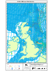
You can access a digital map of the UK Continental Shelf (UKCS) oil and gas activity by individual quadrant - (updated 08 August 2016) , showing the licensed areas, and below it pop-up detailed maps of each of the quadrants that contain licensed areas.
Interactive map
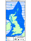
This interactive map has been produced by the OGA to assist companies and members of the public with information that will help understand oil and gas exploration and production activity in the UK’s Territorial Sea and its designated Continental Shell (“the offshore area”). This includes those areas already under licence and those areas that are on offer in the OGA’s licensing Rounds.
UK Government Funded Seismic Projects
| Description | Download |
| Rockall seismic lines acquired in 2015 (8896km) and seismic lines acquired in 2014 (1117km). All form part of the Rockall Government Funded Seismic Project | Shapefile |
| Mid North Sea High lines acquired in 2015 (10849km) | Shapefile |
| Rockall legacy lines (Post Stack & Reprocessed) | Shapefile |
| Mid North Sea High legacy lines (Post Stack and Reprocessed) | Shapefile |
Spatial data for the UK Government funded seismic projects is available as various web services from OGA Government Seismic data
The Crown Estate interests
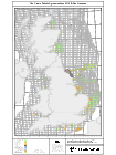
The Crown Estate Agreements including Leases, Licences, Agreements for Lease and Search Areas (overlaying UKCS Petroleum Licensing Blocks)
This map is designed to assist petroleum licence holders to identify any area conflicts that their petroleum licences have with other users of the sea that have been granted rights by The Crown Estate.
Petroleum licence holders should identify any blocks where they hold a licence or plan to gain a licence to check whether there may be a potential area conflict with another rights holder. This could involve a physical overlap between a petroleum licence and a Crown Estate agreement or it could be a potential conflict if the areas are adjoining or in close proximity to each other (e.g. a helicopter zone may overlap with a Crown Estate lease).
Petroleum licence holders are strongly advised to contact the other rights holder(s) at the earliest opportunity to discuss and resolve any potential conflicts. In addition to this, if the licence sits within or partially within the 12 nautical mile territorial limit, licence holders must also contact The Crown Estate in order to be granted an agreement for seabed rights.
Further details are available on The Crown Estate web
Petroleum licence holders can contact The Crown Estate at oilandgasenquiries@thecrownestate.co.uk or on 020 7851 5343 with general or specific questions.
Oil and Gas Clause in Crown Estate leases
Under the terms of Crown Estate offshore renewable leases and agreements for lease, The Crown Estate may determine (i.e. terminate) the lease or agreement for lease in whole or part, following a request from the Secretary of State, for the purposes of allowing an oil or gas development to proceed. This is known as the “oil and gas clause”.
Where it emerges that the plans of an oil or gas developer and those of an offshore renewables developer may be in conflict, the parties are expected to make every reasonable effort to reach a commercial agreement at the earliest stage. The Secretary of State has made clear that he will only request that The Crown Estate determine a lease or agreement for lease after appropriate compensation has been paid by an oil or gas developer to the affected offshore renewable developer(s), or after a binding agreement has been entered with an oil or gas developer to pay such compensation. Read the Secretary of State’s Written Statement to Parliament.
Where the oil or gas developer and the offshore renewables developer are unable to reach a commercial agreement on compensation and the determination of the lease or agreement for lease is necessary for the oil or gas development to go ahead, the oil or gas developer can make an application to the Secretary of State to appoint an independent valuer to assess the appropriate level of compensation. Guidance on the procedure is available below.

Offshore GIS Data
Data is provided in Shapefile and KML format. This allows our data to be used with a wide variety of software and applications. It is updated on a weekly basis.
We also offer a Web Feature Service (WFS) hosted with ESRI using their REST specification. If you would like more information about this please e-mail John.Seabourn@oga.gsi.gov.uk
To use the KML files copy and paste the link into your mapping software e.g. Google earth or if you’d prefer to download to your system right click and ‘save target as’.
29th Round
| Description | ||
| Indicative areas to be offered during 29th offshore round (Actual areas have not been finalised and are subject to change) | Shapefile | KML |
| Current blocks that are excluded or carry restrictions for licensing rounds | Shapefile | KML |
28th Round
| Description | ||
| Second Tranche of blocks awarded during the 28th Round | Shapefile | KML |
| First Tranche of blocks awarded during the 28th Round | Shapefile | KML |
| Blocks offered for the 28th Round of Oil and Gas Licensing on the 28/01/2014 | Shapefile | KML |
| Blocks that have been relinquished since the start of the 28th Round of Oil and Gas Licensing | Shapefile | KML |
27th Round
| Description | ||
| Blocks for which applications were received during the 27th Round | Shapefile | KML |
| Blocks offered for the 27th Round of Oil and Gas Licensing on the 01/02/2012 | Shapefile | KML |
| Blocks that have been relinquished during the 27th Round of Oil and Gas Licensing | Shapefile | KML |
| First Tranche of blocks awarded during the 27th Round | Shapefile | KML |
| Second Tranche of blocks awarded during the 27th Round | Shapefile | KML |
Current UKCS data (updated 12 September 2016)
| Description | ||
| All offshore data | Shapefile | KML |
| Simple coastline of the UK and surrounding European nations | Shapefile | KML |
| Blocks considered fallow with no significant activity for 3 years | Shapefile | KML |
| Discoveries considered fallow with no significant activity for 3 years | Shapefile | KML |
| Blocks where current licences are not progressing towards any activity | Shapefile | KML |
| Discoveries where current licences are not progressing towards any activity | Shapefile | KML |
| Taxation boundaries of offshore hydrocarbon fields on the UKCS | Shapefile | KML |
| Major geological basins on the UKCS | Shapefile | KML |
| Sub geological basins on the UKCS | Shapefile | KML |
| Hydrocarbon fields on the UKCS – not an accurate reflection of reservoir boundaries | Shapefile | KML |
| Grid of licences only – taken directly from the Energy Portal | Shapefile | KML |
| Grid of all licensed and unlicensed blocks on the UKCS – Intend as a guide. | Shapefile | KML |
| Grid of licensed blocks only – taken directly from the Energy Portal | Shapefile | KML |
| Extent of UKCS – Does not contain definitive legal boundaries | Shapefile | KML |
| Grid of DECC quadrants (1 degree by 1 degree) across the UKCS | Shapefile | KML |
| Boundary for the application of English and Scottish civil law in relation to offshore renewable energy installations | Shapefile | KML |
| Strategic Environmental Assessment (SEA) areas. Areas considered for environmental protection and suitable development | Shapefile | KML |
| Discoveries identified as ‘significant’ by DECC in terms of flow rate. Does not indicate commercial potential, but identifies those with an approved or in production field development plan | Shapefile | KML |
| Grid of licence Sub Areas – taken directly from the Energy Portal. (Contains all information on Operators, Administrators and Equity) | Shapefile | KML |
| Surface Location of all UK offshore wells | Shapefile | KML |
| Pipelines Not maintained by the OGA – See UK Oil and Gas Data for shapefile | ||
| Wind Farm Areas Not maintained by the OGA – See The Crown Estate for shapefile |
Disclaimer
This data is supplied on a best effort basis only, utilising available information as provided by the original operators. While every effort is made to ensure the information is correct and up-to-date, the Department does not accept any liability for any direct, indirect or consequential loss or damage of any nature, however caused, which may be sustained as a result of reliance upon such information.
You may re-use this information (not including logos) free of charge in any format or medium, under the terms of the Open Government Licence or write to the Information Policy Team, The National Archives, Kew, London TW9 4DU, or email: psi@nationalarchives.gsi.gov.uk.
If any errors are found or if you have any comments or other queries please contact:
John Seabourn
GIS Manager
Telephone: 0300 068 8138
Email: John.Seabourn@oga.gsi.gov.uk
Last updated 8 August 2016 + show all updates
-
Maps and Shapefiles - (updated)
-
Offshore maps - (updated)
-
Maps and shapefiles - (updated)
-
Maps and shapefiles - (updated)
-
Offshore maps and shapefiles - (updated)
-
Oil and Gas Authority: Updated offshore maps and GIS Shapefiles
-
Quadrant Maps and Shapefiles - (updated)
-
Offshore maps and shapefiles - (updated)
-
Offshore maps and shapefiles - (updated)
-
Offshore shapefiles - (updated)
-
Shapefiles - (updated)
-
Various Maps - (updated)
-
Oil and Gas: Updated shapefiles,quadmaps and UKCS data date
-
Oil and Gas: Updated date of UKCS data date
-
Oil and Gas: Updated offshore map data and shapefiles
-
Offshore quadrant maps and shapefiles - (updated)
-
Shapefiles and Quadrant Maps - (updated)
-
28th Offshore Licensing Round shapefiles - (added)
-
Offshore Maps: Infrastructure and Quadrant maps - (updated)
-
Quadrant maps and shapefiles - (updated)
-
Offshore Maps- Quadrant maps and shapefiles - (updated)
-
Offshore quadrant maps and shapefiles - (updated)
-
Oil and Gas: Update of shapefiles and map data
-
Updated the offshore Map Files
-
Oil and gas: Offshore maps, shapefiles and quad maps - (updated)
-
Oil and gas: Offshore maps, quad maps and shapefiles - (updated)
-
Oil and gas: Offshore maps, shapefiles and quadrant maps - (updated)
-
Oil and gas: Offshore shapefiles and Quadrant maps - (updated)
-
Oil and gas: Quad maps, infrastructure and current licence position - (updated)
-
Oil and Gas: Update of map data and shapefiles.
-
Oil and Gas: Update of shapefile and map data.
-
Oil and Gas: Update of shapefiles and map data
-
Oil and Gas: Update of map data pdf's
-
Oil and Gas: Update of shapefiles and map data
-
Oil and gas: Offshore quad maps and shapefiles - (updated)
-
Oil and Gas: Update of map data and shapefiles
-
Oil and gas: Offshore Maps and Shapefiles - (updated)
-
Oil and gas: Offshore shapefiles - (updated)
-
Oil and Gas: Update of offshore maps and shapefiles
-
Oil and gas: Offshore map shapefiles - (updated)
-
OIl and gas: Offshore maps and shapefiles - (updated)
-
Oil and gas: Offshore maps and shapefiles - (updated)
-
Oil and gas: Maps and shapefiles - (updated)
-
Oil and gas: Offshore maps - Quadrant maps andshapefiles - (updated)
-
Oil and gas: 28th licensing round First Tranche of blocks awarded during the 28th Round shapefiles - (added)
-
Oil and gas: Offshore maps and shapefiles - (updated)
-
Oil and gas: Offshore map shapefiles - (updated)
-
Oil and gas: Offshore map shapefiles - (updated)
-
Oil and gas: Update of shapefiles and mapdata
-
Oil and gas: various maps - (updated)
-
Oil and gas: Shapefiles updated
-
Oil and gas: Update of shapefiles and map data as of 22/09/14
-
Oil and gas: Update of map data and shapefiles
-
Oil and Gas: Update of Maps and Shapefiles. Updated as of 08/09/2014.
-
Oil and gas: Maps and shapefiles - (updated)
-
Oil and gas: Various shapefiles - (updated)
-
Oil and gas: Interactive map - (added)
-
Oil and gas: Maps and shapefiles - (updated)
-
Oil and gas: KML versons of shapefiles added
-
xxx
-
Oil and Gas: Various offshore maps and shapefiles updated
-
Oil and gas: Various maps - (updated)
-
Oil and gas: Various offshore maps and shapefiles updated
-
Oil and gas: Various offshore maps and shapefiles - (updated)
-
Oil and gas: Offshore maps - (updated)
-
Oil and gas; 28th offshore round offer shapefiles - (added)
-
Oil and gas: various offshore maps and shapefiles - (updated)
-
Oil and gas: offshore maps - (updated)
-
Oil and gas: offshore map updated
-
TCE Leases and OG Licences map updated
-
Oil and gas: offshore map updated
-
Oil and gas: various offshore maps updates
-
Oil and gas: various maps updated
-
Oil and gas maps: Geological Basins shapefile - added
-
Various offshore maps and shapefiles - updated
-
Updated various maps and shapefiles
-
Updated maps
-
Updated various maps
-
Add link to quad maps
-
First published.